
Thank you for supporting this site ❤️
Make a donation
Make a donation
Gear up for your next adventure:
As an Amazon Associate, this site earns from qualifying purchases at no extra cost to you.
Bassano topographic map
Click on the map to display elevation.
Thank you for supporting this site ❤️
Make a donation
Make a donation
Gear up for your next adventure:
As an Amazon Associate, this site earns from qualifying purchases at no extra cost to you.
About this map
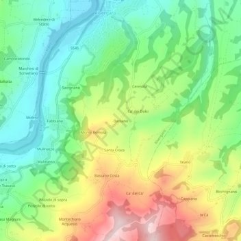
Name: Bassano topographic map, elevation, terrain.
Location: Bassano, Rivergaro, Piacenza, Emilia-Romagna, 29029, Italia (44.87231 9.58015 44.91231 9.62015)
Average elevation: 886 ft
Minimum elevation: 407 ft
Maximum elevation: 1,670 ft
Thank you for supporting this site ❤️
Make a donation
Make a donation
Gear up for your next adventure:
As an Amazon Associate, this site earns from qualifying purchases at no extra cost to you.