
Thank you for supporting this site ❤️
Make a donation
Make a donation
Gear up for your next adventure:
As an Amazon Associate, this site earns from qualifying purchases at no extra cost to you.
Sarra topographic map
Click on the map to display elevation.
Thank you for supporting this site ❤️
Make a donation
Make a donation
Gear up for your next adventure:
As an Amazon Associate, this site earns from qualifying purchases at no extra cost to you.
About this map
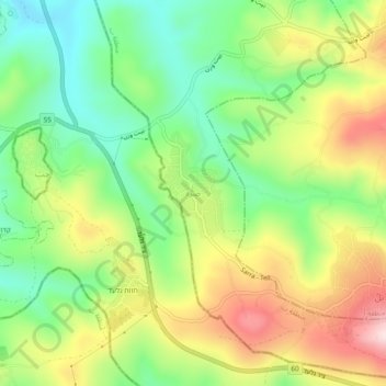
Name: Sarra topographic map, elevation, terrain.
Location: Sarra, Area B, West Bank, 1922, Palestinian Territory (32.18955 35.17019 32.22955 35.21019)
Average elevation: 1,634 ft
Minimum elevation: 1,122 ft
Maximum elevation: 2,333 ft
Thank you for supporting this site ❤️
Make a donation
Make a donation
Gear up for your next adventure:
As an Amazon Associate, this site earns from qualifying purchases at no extra cost to you.