Geolocate

Montclair topographic map

Click on the map to display elevation.

About this map

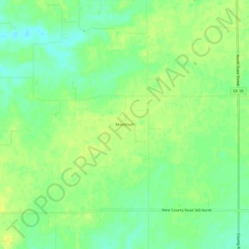
Name: Montclair topographic map, elevation, terrain.

Location: Montclair, Hendricks County, Indiana, 46149, United States (39.82810 -86.58695 39.86810 -86.54695)

Average elevation: 951 ft

Minimum elevation: 919 ft

Maximum elevation: 974 ft

Hendricks County trails, hiking, mountain biking, running and outdoor activities

Other topographic maps

Click on a map to view its topography, its elevation and its terrain.

North Salem

United States > Indiana > Hendricks County

Average elevation: 912 ft

Stilesville

United States > Indiana > Hendricks County

Average elevation: 787 ft

Coatesville

United States > Indiana > Hendricks County

Average elevation: 889 ft

Pittsboro

United States > Indiana > Hendricks County

Average elevation: 935 ft

Amo

United States > Indiana > Hendricks County

Average elevation: 837 ft

Avon

United States > Indiana > Hendricks County

Average elevation: 833 ft

Danville

United States > Indiana > Hendricks County

Average elevation: 922 ft

Clayton

United States > Indiana > Hendricks County

Average elevation: 863 ft

Lizton

United States > Indiana > Hendricks County

Average elevation: 958 ft

Gear up for your next adventure:

🔋Solar Power Banks - Keep your GPS and phone charged in remote wilderness areas
🪶Camp Gear Gift Set - Perfect gift bundle for outdoor fans
🔦Powerful Headlamps - Ultra-bright hands-free lighting for night navigation
🧭GPS Watch Accessories - Bands and chargers for GPS watches
🧺Microfiber Travel Towels - Compact and fast-drying towels for trail use

As an Amazon Associate, this site earns from qualifying purchases at no extra cost to you.