Geolocate

Gilliland topographic map

Click on the map to display elevation.

About this map

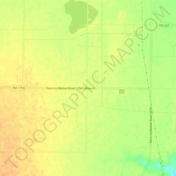
Name: Gilliland topographic map, elevation, terrain.

Location: Gilliland, Knox County, Texas, United States (33.71148 -99.70342 33.75148 -99.66342)

Average elevation: 1,509 ft

Minimum elevation: 1,434 ft

Maximum elevation: 1,542 ft

Knox County trails, hiking, mountain biking, running and outdoor activities

Other topographic maps

Click on a map to view its topography, its elevation and its terrain.

Benjamin

United States > Texas > Knox County

Average elevation: 1,483 ft

Munday

United States > Texas > Knox County

Average elevation: 1,490 ft

Goree

United States > Texas > Knox County

Average elevation: 1,440 ft

Knox City

United States > Texas > Knox County

Average elevation: 1,539 ft

Gear up for your next adventure:

📱Heavy-Duty Phone Cases - Drop-proof and waterproof protection for outdoor navigation
🎒Hydration Pack - Hands‑free water reservoir for long hikes
🔭Stargazing Telescopes - Perfect for camping in low-light pollution areas shown on maps
🔭Telescopic Hiking Pole - Adjustable pole for hiking stability
🛠️Outdoor Gear Repair Kit - Essential tools to fix gear on the trail

As an Amazon Associate, this site earns from qualifying purchases at no extra cost to you.