
Thank you for supporting this site ❤️
Make a donation
Make a donation
Gear up for your next adventure:
As an Amazon Associate, this site earns from qualifying purchases at no extra cost to you.
Sherwood topographic map
Click on the map to display elevation.
Thank you for supporting this site ❤️
Make a donation
Make a donation
Gear up for your next adventure:
As an Amazon Associate, this site earns from qualifying purchases at no extra cost to you.
About this map
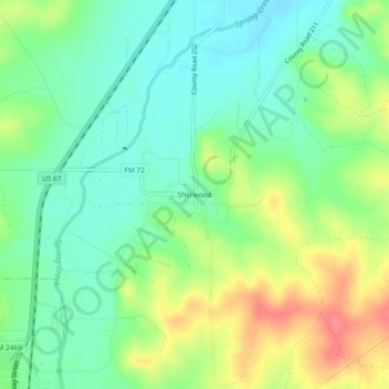
Name: Sherwood topographic map, elevation, terrain.
Location: Sherwood, Irion County, Texas, 76941, United States (31.26128 -100.81538 31.30128 -100.77538)
Average elevation: 2,208 ft
Minimum elevation: 2,126 ft
Maximum elevation: 2,336 ft
Irion County trails, hiking, mountain biking, running and outdoor activities
Thank you for supporting this site ❤️
Make a donation
Make a donation
Gear up for your next adventure:
As an Amazon Associate, this site earns from qualifying purchases at no extra cost to you.
Other topographic maps
Click on a map to view its topography, its elevation and its terrain.