
Thank you for supporting this site ❤️
Make a donation
Make a donation
Gear up for your next adventure:
As an Amazon Associate, this site earns from qualifying purchases at no extra cost to you.
Montargano topographic map
Click on the map to display elevation.
Thank you for supporting this site ❤️
Make a donation
Make a donation
Gear up for your next adventure:
As an Amazon Associate, this site earns from qualifying purchases at no extra cost to you.
About this map
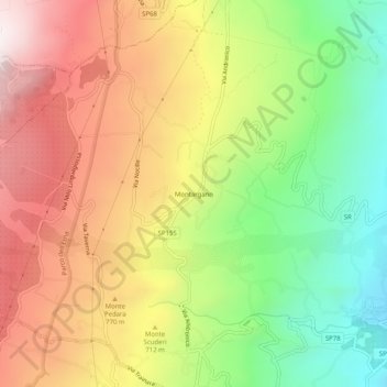
Name: Montargano topographic map, elevation, terrain.
Location: Montargano, Mascali, Catania, Sicilia, 95016, Italia (37.75006 15.12212 37.79006 15.16212)
Average elevation: 2,103 ft
Minimum elevation: 705 ft
Maximum elevation: 3,537 ft
Thank you for supporting this site ❤️
Make a donation
Make a donation
Gear up for your next adventure:
As an Amazon Associate, this site earns from qualifying purchases at no extra cost to you.