Geolocate

Champakulam topographic map

Click on the map to display elevation.

About this map

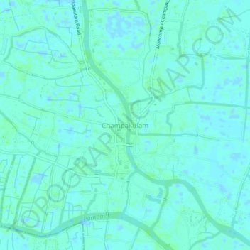
Name: Champakulam topographic map, elevation, terrain.

Location: Champakulam, Kuttanad, Alappuzha District, Kerala, 688505, India (9.39114 76.39151 9.43114 76.43151)

Average elevation: 10 ft

Minimum elevation: -10 ft

Maximum elevation: 20 ft

Other topographic maps

Click on a map to view its topography, its elevation and its terrain.

Pulinkunnu

India > Kerala > Kuttanad > Pullincunoo

Average elevation: 7 ft

Veliyanadu Kidangara Ferry

India > Kerala > Kuttanad

Average elevation: 7 ft

Pulinkunnu

India > Kerala > Kuttanad > Pullincunoo

Average elevation: 7 ft

Gear up for your next adventure:

🧭Pro Hiking Compasses - High-accuracy liquid-filled compasses for topographic orientation
🔭Compact Binoculars - HD vision for scouting terrain and identifying distant landmarks
🔭Telescopic Hiking Pole - Adjustable pole for hiking stability
💧Water Filtration Bottles - Safely drink from streams and lakes while exploring
🥤Water Filter Bottle - All‑in‑one filter bottle for safe hydration

As an Amazon Associate, this site earns from qualifying purchases at no extra cost to you.