Geolocate

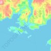
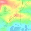
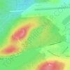
Lumsden topographic map

Click on the map to display elevation.

About this map

Name: Lumsden topographic map, elevation, terrain.

Location: Lumsden, Newfoundland, Newfoundland and Labrador, A0G 1N0, Canada (49.25045 -53.64518 49.34486 -53.52166)

Average elevation: 33 ft

Minimum elevation: -16 ft

Maximum elevation: 154 ft

Other topographic maps

Click on a map to view its topography, its elevation and its terrain.
Botwood

Canada > Newfoundland and Labrador > Botwood

Average elevation: 56 ft

LaScie

Canada > Newfoundland and Labrador

Average elevation: 322 ft

Spot Pond

Canada > Newfoundland and Labrador

Average elevation: 387 ft

Daniels Gulch

Canada > Newfoundland and Labrador

Average elevation: 1,522 ft

The Peak

Canada > Newfoundland and Labrador

Average elevation: 220 ft

Roundabout

Canada > Newfoundland and Labrador

Average elevation: 213 ft

White Horse

Canada > Newfoundland and Labrador

Average elevation: 325 ft

Boat Harbour

Canada > Newfoundland and Labrador

Average elevation: 282 ft

The Cabox

Canada > Newfoundland and Labrador

Average elevation: 2,290 ft

Gear up for your next adventure:

🧺Microfiber Travel Towels - Compact and fast-drying towels for trail use
🎒Trail Energy Bars - High‑calorie bars for hiking energy
🏫Relief Map Kits - Hands-on tools for teaching landforms and elevation
🧭GPS Watch Accessories - Bands and chargers for GPS watches
🧢Outdoor Hiking Hat - Sun protection hat for outdoor explorers

As an Amazon Associate, this site earns from qualifying purchases at no extra cost to you.