Geolocate

Carn Hill topographic map

Click on the map to display elevation.

About this map

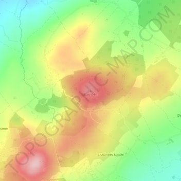
Name: Carn Hill topographic map, elevation, terrain.

Location: Carn Hill, Letterkenny, County Donegal, F92 W8CY, Ireland (54.99698 -7.69586 54.99708 -7.69576)

Average elevation: 472 ft

Minimum elevation: 128 ft

Maximum elevation: 827 ft

Other topographic maps

Click on a map to view its topography, its elevation and its terrain.

Lough Nagreany

Ireland > County Donegal > Letterkenny

Average elevation: 118 ft

Kindrum

Ireland > County Donegal > Letterkenny

Average elevation: 161 ft

Bomany

Ireland > County Donegal > Letterkenny

Average elevation: 203 ft

Church Hill

Ireland > County Donegal > Letterkenny

Average elevation: 384 ft

Stragraddy

Ireland > County Donegal > Letterkenny

Average elevation: 387 ft

Glen Lough

Ireland > County Donegal > Letterkenny

Average elevation: 292 ft

Lisnenan

Ireland > County Donegal > Letterkenny

Average elevation: 331 ft

Glencar Scotch

Ireland > County Donegal > Letterkenny

Average elevation: 440 ft

Meenlaragh

Ireland > County Donegal > Letterkenny

Average elevation: 623 ft

Killydonnell

Ireland > County Donegal > Letterkenny

Average elevation: 135 ft

Letterkenny

Ireland > County Donegal > Letterkenny

Average elevation: 138 ft

Dooballagh

Ireland > County Donegal > Letterkenny

Average elevation: 545 ft

Ballygreen

Ireland > County Donegal > Letterkenny

Average elevation: 43 ft

Loughnagin

Ireland > County Donegal > Letterkenny

Average elevation: 240 ft

Windyhall

Ireland > County Donegal > Letterkenny > Windhall

Average elevation: 387 ft

Loughros Glebe

Ireland > County Donegal > Letterkenny

Average elevation: 259 ft

Sallaghagrane

Ireland > County Donegal > Letterkenny

Average elevation: 187 ft

Barrack

Ireland > County Donegal > Letterkenny

Average elevation: 377 ft

Lough Salt

Ireland > County Donegal > Letterkenny

Average elevation: 807 ft

Pluck

Ireland > County Donegal > Letterkenny

Average elevation: 98 ft

Carrickart

Ireland > County Donegal > Letterkenny

Average elevation: 233 ft

Church Hill

Ireland > County Donegal > Letterkenny

Average elevation: 384 ft

Gear up for your next adventure:

🧢Sun Protection Hats - Wide-brimmed and UPF-rated hats for high-altitude sun safety
GPS Sports Watch - GPS watch for running, hiking and training
💧Water Purification System - Clean water on the trail with reliable purifiers
🌄Hiking Binoculars - Compact binoculars for scenic views and trail spotting
🪶LED Camping Lantern - Bright lantern for camp lighting

As an Amazon Associate, this site earns from qualifying purchases at no extra cost to you.