Geolocate

Monción topographic map

Click on the map to display elevation.

About this map

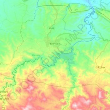
Name: Monción topographic map, elevation, terrain.

Location: Monción, Santiago Rodríguez, Dominican Republic (19.30554 -71.27248 19.47624 -71.07201)

Average elevation: 1,365 ft

Minimum elevation: 341 ft

Maximum elevation: 3,291 ft

Gear up for your next adventure:

🧣Hiking Neck Gaiter - Multi‑use neck protection for outdoor weather
🏫Relief Map Kits - Hands-on tools for teaching landforms and elevation
🌡️Portable Weather Meter - Track weather conditions on the trail
☀️Outdoor Sunscreen - High protection sunscreen for outdoor activities
🔋Solar Power Banks - Keep your GPS and phone charged in remote wilderness areas

As an Amazon Associate, this site earns from qualifying purchases at no extra cost to you.