Geolocate

Mentor topographic map

Interactive map

Click on the map to display elevation.

About this map

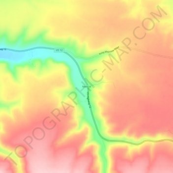
Name: Mentor topographic map, elevation, terrain.

Location: Mentor, Garfield County, Washington, United States (46.43904 -117.49268 46.47904 -117.45268)

Average elevation: 2,566 ft

Minimum elevation: 2,162 ft

Maximum elevation: 2,795 ft

Other topographic maps

Click on a map to view its topography, its elevation and its terrain.

Pomeroy

United States > Washington > Garfield County

Pomeroy, Garfield County, Washington, 99347, United States

Average elevation: 2,188 ft

Pataha

United States > Washington > Garfield County

Pataha, Garfield County, Washington, 99347, United States

Average elevation: 2,343 ft

Mayview

United States > Washington > Garfield County

Mayview, Garfield County, Washington, United States

Average elevation: 2,241 ft