Geolocate

Marz topographic map

Click on the map to display elevation.

About this map

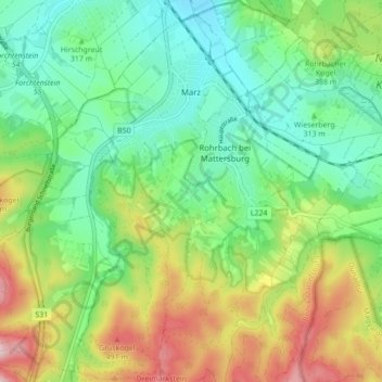
Name: Marz topographic map, elevation, terrain.

Location: Marz, Bezirk Mattersburg, Burgenland, 7221, Austria (47.67471 16.36352 47.73308 16.44234)

Average elevation: 1,112 ft

Minimum elevation: 745 ft

Maximum elevation: 1,804 ft

Gear up for your next adventure:

🎒Trail Energy Bars - High‑calorie bars for hiking energy
🌐World Map Poster - Decorative world maps with topographic info
🚁Photography Drones - Capture stunning aerial views of landforms and topography
🎒Waterproof Dry Bags - Keep your electronics and maps dry inside your pack
🥇GPS Hiking Watch - Multi‑sport GPS watch with navigation and trail tracking

As an Amazon Associate, this site earns from qualifying purchases at no extra cost to you.