
Make a donation
Gear up for your next adventure:
As an Amazon Associate, this site earns from qualifying purchases at no extra cost to you.
Linde topographic map
Click on the map to display elevation.
Make a donation
Gear up for your next adventure:
As an Amazon Associate, this site earns from qualifying purchases at no extra cost to you.
About this map
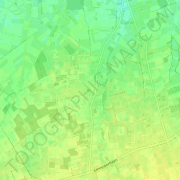
Name: Linde topographic map, elevation, terrain.
Location: Linde, Peer, Maaseik, Limburg, 3990, België (51.07605 5.42398 51.11605 5.46398)
Average elevation: 230 ft
Minimum elevation: 197 ft
Maximum elevation: 253 ft
Make a donation
Gear up for your next adventure:
As an Amazon Associate, this site earns from qualifying purchases at no extra cost to you.
Other topographic maps
Click on a map to view its topography, its elevation and its terrain.
Make a donation
Gear up for your next adventure:
As an Amazon Associate, this site earns from qualifying purchases at no extra cost to you.
Kleine-Brogel
België > Limburg > Maaseik > Peer
Kleine-Brogel ligt op de noordflank van het Kempens Plateau, op een hoogte tot 60 meter. In het westen vindt men het dal van de Dommel, op welke rivier ook een aantal watermolens te vinden zijn, namelijk Kleine Molen en Wedelse Molen, welke echter tot de gemeente Pelt behoren.
Average elevation: 171 ft