
Make a donation
Gear up for your next adventure:
As an Amazon Associate, this site earns from qualifying purchases at no extra cost to you.
Kremlin topographic map
Click on the map to display elevation.
Make a donation
Gear up for your next adventure:
As an Amazon Associate, this site earns from qualifying purchases at no extra cost to you.
About this map
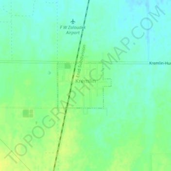
Name: Kremlin topographic map, elevation, terrain.
Location: Kremlin, Garfield County, Oklahoma, 73753, United States (36.54292 -97.83696 36.55019 -97.82640)
Average elevation: 1,119 ft
Minimum elevation: 1,089 ft
Maximum elevation: 1,152 ft
Garfield County trails, hiking, mountain biking, running and outdoor activities
Make a donation
Gear up for your next adventure:
As an Amazon Associate, this site earns from qualifying purchases at no extra cost to you.
Other topographic maps
Click on a map to view its topography, its elevation and its terrain.
Make a donation
Gear up for your next adventure:
As an Amazon Associate, this site earns from qualifying purchases at no extra cost to you.