
赵李桥镇 topographic map
Interactive map
Click on the map to display elevation.
About this map
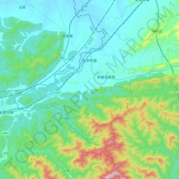
Name: 赵李桥镇 topographic map, elevation, terrain.
Location: 赵李桥镇, 赤壁市, 咸宁市, 湖北省, 中国 (29.47202 113.62433 29.59544 113.84584)
Average elevation: 699 ft
Minimum elevation: 95 ft
Maximum elevation: 2,992 ft
Other topographic maps
Click on a map to view its topography, its elevation and its terrain.