Geolocate

Lambingan topographic map

Click on the map to display elevation.

About this map

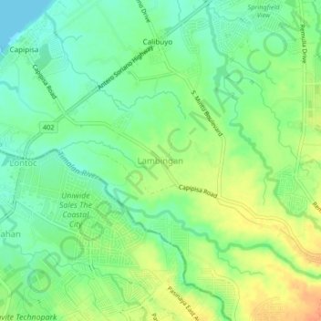
Name: Lambingan topographic map, elevation, terrain.

Location: Lambingan, Tanza, Cavite, Calabarzon, 4108, Philippines (14.32507 120.78975 14.36507 120.82975)

Average elevation: 56 ft

Minimum elevation: 0 ft

Maximum elevation: 131 ft

Gear up for your next adventure:

🪶Multi‑Purpose Knife - Useful blade for camp and trail
🎒Hydration Pack - Hands‑free water reservoir for long hikes
❄️Traction Cleats - Prevent slips on icy trails during winter hikes
🎒Trail Energy Bars - High‑calorie bars for hiking energy
🪄Magnetic Compass - Accurate compass for navigation

As an Amazon Associate, this site earns from qualifying purchases at no extra cost to you.