
Thank you for supporting this site ❤️
Make a donation
Make a donation
Gear up for your next adventure:
As an Amazon Associate, this site earns from qualifying purchases at no extra cost to you.
Sukajadi topographic map
Click on the map to display elevation.
Thank you for supporting this site ❤️
Make a donation
Make a donation
Gear up for your next adventure:
As an Amazon Associate, this site earns from qualifying purchases at no extra cost to you.
About this map
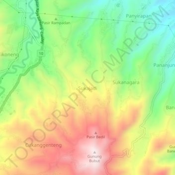
Name: Sukajadi topographic map, elevation, terrain.
Location: Sukajadi, Bandung, West Java, 40912, Indonesia (-7.08634 107.49009 -7.04634 107.53009)
Average elevation: 3,258 ft
Minimum elevation: 2,310 ft
Maximum elevation: 4,350 ft
Thank you for supporting this site ❤️
Make a donation
Make a donation
Gear up for your next adventure:
As an Amazon Associate, this site earns from qualifying purchases at no extra cost to you.