Geolocate

Kherad topographic map

Click on the map to display elevation.

About this map

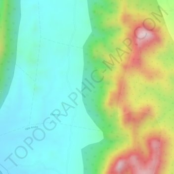
Name: Kherad topographic map, elevation, terrain.

Location: Kherad, Jhadol Tehsil, Udaipur District, Rajasthan, India (24.23581 73.31370 24.25133 73.33280)

Average elevation: 1,778 ft

Minimum elevation: 1,296 ft

Maximum elevation: 2,694 ft

Other topographic maps

Click on a map to view its topography, its elevation and its terrain.

Sagpura

India > Rajasthan > Jhadol Tehsil

Average elevation: 1,759 ft

Nawla

India > Rajasthan > Jhadol Tehsil

Average elevation: 1,919 ft

Gear up for your next adventure:

🚁Photography Drones - Capture stunning aerial views of landforms and topography
🧭GPS Watch Accessories - Bands and chargers for GPS watches
🖼️Topo Map Wall Art - Decorative topographic prints of famous peaks and regions
🕶️Glacier Sunglasses - Side shields to protect eyes from high-altitude snow glare
🪶Camp Gear Gift Set - Perfect gift bundle for outdoor fans

As an Amazon Associate, this site earns from qualifying purchases at no extra cost to you.