
Thank you for supporting this site ❤️
Make a donation
Make a donation
Gear up for your next adventure:
As an Amazon Associate, this site earns from qualifying purchases at no extra cost to you.
Rizal topographic map
Click on the map to display elevation.
Thank you for supporting this site ❤️
Make a donation
Make a donation
Gear up for your next adventure:
As an Amazon Associate, this site earns from qualifying purchases at no extra cost to you.
About this map
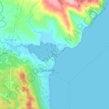
Name: Rizal topographic map, elevation, terrain.
Location: Rizal, Socorro, Surigao del Norte, Caraga, 8416, Philippines (9.60406 125.94742 9.64406 125.98742)
Average elevation: 131 ft
Minimum elevation: 0 ft
Maximum elevation: 633 ft
Thank you for supporting this site ❤️
Make a donation
Make a donation
Gear up for your next adventure:
As an Amazon Associate, this site earns from qualifying purchases at no extra cost to you.