
Thank you for supporting this site ❤️
Make a donation
Make a donation
Gear up for your next adventure:
As an Amazon Associate, this site earns from qualifying purchases at no extra cost to you.
Ön topographic map
Click on the map to display elevation.
Thank you for supporting this site ❤️
Make a donation
Make a donation
Gear up for your next adventure:
As an Amazon Associate, this site earns from qualifying purchases at no extra cost to you.
About this map
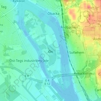
Name: Ön topographic map, elevation, terrain.
Location: Ön, Umeå, Umeå kommun, Västerbotten County, 904 26, Sweden (63.79671 20.26994 63.81865 20.29569)
Average elevation: 36 ft
Minimum elevation: -7 ft
Maximum elevation: 135 ft
Thank you for supporting this site ❤️
Make a donation
Make a donation
Gear up for your next adventure:
As an Amazon Associate, this site earns from qualifying purchases at no extra cost to you.