Geolocate

Lexington Hills topographic map

Interactive map

Click on the map to display elevation.

About this map

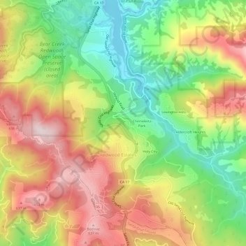
Name: Lexington Hills topographic map, elevation, terrain.

Location: Lexington Hills, Redwood Estates, Santa Clara County, CAL Fire Northern Region, California, United States (37.14085 -122.01679 37.18411 -121.95662)

Average elevation: 1,391 ft

Minimum elevation: 591 ft

Maximum elevation: 2,254 ft

Other topographic maps

Click on a map to view its topography, its elevation and its terrain.

Chemeketa Park

United States > California > Santa Clara County > Redwood Estates

Chemeketa Park, Redwood Estates, Santa Clara County, California, 95033, United States

Average elevation: 1,355 ft

Holy City

United States > California > Santa Clara County > Redwood Estates

Holy City, Redwood Estates, Santa Clara County, California, 95033, United States

Average elevation: 1,407 ft

Lexington Hills

United States > California > Santa Clara County > Redwood Estates > Lexington Hills

Lexington Hills, Redwood Estates, Santa Clara County, California, 95044, United States

Average elevation: 1,332 ft