
Thank you for supporting this site ❤️
Make a donation
Make a donation
Gear up for your next adventure:
As an Amazon Associate, this site earns from qualifying purchases at no extra cost to you.
Diedamskopf topographic map
Click on the map to display elevation.
Thank you for supporting this site ❤️
Make a donation
Make a donation
Gear up for your next adventure:
As an Amazon Associate, this site earns from qualifying purchases at no extra cost to you.
About this map
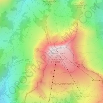
Name: Diedamskopf topographic map, elevation, terrain.
Location: Diedamskopf, Bezau, Bezirk Bregenz, Vorarlberg, 6886, Austria (47.34645 10.02552 47.34655 10.02562)
Average elevation: 5,230 ft
Minimum elevation: 3,904 ft
Maximum elevation: 6,791 ft
Thank you for supporting this site ❤️
Make a donation
Make a donation
Gear up for your next adventure:
As an Amazon Associate, this site earns from qualifying purchases at no extra cost to you.