Geolocate

Mecca topographic map

Click on the map to display elevation.

About this map

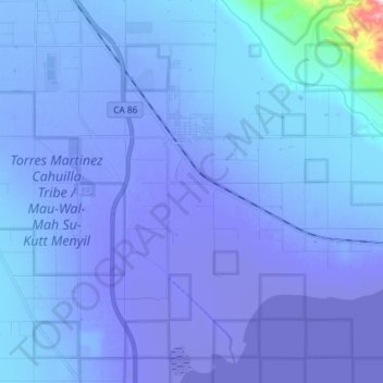
Name: Mecca topographic map, elevation, terrain.

Location: Mecca, Riverside County, California, 92254, United States (33.50482 -116.12018 33.59874 -115.97395)

Average elevation: -135 ft

Minimum elevation: -236 ft

Maximum elevation: 1,079 ft

Riverside County trails, hiking, mountain biking, running and outdoor activities

Gear up for your next adventure:

🔋Rechargeable Batteries - Power up your outdoor devices
🔌USB Car Charger - Car charger for on‑the‑go power needs
🛠️Outdoor Gear Repair Kit - Essential tools to fix gear on the trail
🏕️Family Camping Gear - Essentials for group camping trips
🥾Women's Hiking Boots - Top-rated trail boots with ankle support and superior grip

As an Amazon Associate, this site earns from qualifying purchases at no extra cost to you.