Geolocate

Wassertrüdingen topographic map

Click on the map to display elevation.

About this map

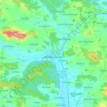
Name: Wassertrüdingen topographic map, elevation, terrain.

Location: Wassertrüdingen, Ansbach (district), Bavaria, 91717, Germany (49.00571 10.48619 49.08395 10.68795)

Average elevation: 1,526 ft

Minimum elevation: 1,358 ft

Maximum elevation: 2,241 ft

Other topographic maps

Click on a map to view its topography, its elevation and its terrain.

Eyerlohe

Germany > Bavaria > Ansbach (district)

Average elevation: 1,417 ft

Rohrbach

Germany > Bavaria > Ansbach (district) > Bechhofen > Rohrbach

Average elevation: 1,463 ft

Neunkirchen

Germany > Bavaria > Ansbach (district) > Leutershausen

Average elevation: 1,539 ft

Gear up for your next adventure:

🧣Merino Neck Gaiters - Multi-functional headwear for wind and sun protection
🥾Men's Hiking Boots - Durable, waterproof footwear for rugged terrain and steep inclines
💧Water Filtration Bottles - Safely drink from streams and lakes while exploring
📷Action Camera - Capture your outdoor adventures in HD
🪄Magnetic Compass - Accurate compass for navigation

As an Amazon Associate, this site earns from qualifying purchases at no extra cost to you.