
Thank you for supporting this site ❤️
Make a donation
Make a donation
Gear up for your next adventure:
As an Amazon Associate, this site earns from qualifying purchases at no extra cost to you.
Redeyef topographic map
Click on the map to display elevation.
Thank you for supporting this site ❤️
Make a donation
Make a donation
Gear up for your next adventure:
As an Amazon Associate, this site earns from qualifying purchases at no extra cost to you.
About this map
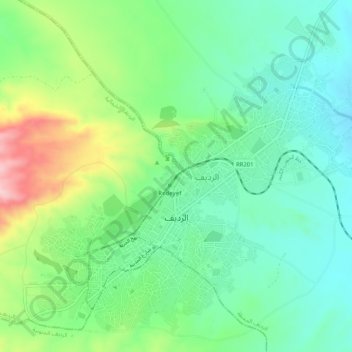
Name: Redeyef topographic map, elevation, terrain.
Location: Redeyef, الرديف المحطة, معتمدية الرديف, Gafsa, Tunisia (34.37016 8.13143 34.40844 8.18340)
Average elevation: 1,919 ft
Minimum elevation: 1,693 ft
Maximum elevation: 2,415 ft
Thank you for supporting this site ❤️
Make a donation
Make a donation
Gear up for your next adventure:
As an Amazon Associate, this site earns from qualifying purchases at no extra cost to you.