

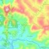
Sadabe topographic map
Click on the map to display elevation.
About this map

Name: Sadabe topographic map, elevation, terrain.
Average elevation: 4,426 ft
Minimum elevation: 3,225 ft
Maximum elevation: 5,295 ft
Other topographic maps
Click on a map to view its topography, its elevation and its terrain.

Mandraka
Madagascar > Analamanga > District de Manjakandriana > Ambatolaona
Average elevation: 4,229 ft

Angavokely
Madagascar > Analamanga > District de Manjakandriana > Nandihizana Carion > Ambohijafy
Average elevation: 4,856 ft

Andandemy
Madagascar > Analamanga > District de Manjakandriana > Miadanandriana
Average elevation: 4,698 ft


Angavokely
Madagascar > Analamanga > District de Manjakandriana > Alarobia
Average elevation: 4,944 ft

Carion
Madagascar > Analamanga > District de Manjakandriana > Nandihizana Carion
Average elevation: 4,590 ft

Rangaina
Madagascar > Analamanga > District de Manjakandriana > Amboahangy
Average elevation: 4,436 ft
Angavokely
Madagascar > Analamanga > District de Manjakandriana > Alarobia
Average elevation: 4,944 ft
Maharidaza
Madagascar > Analamanga > District de Manjakandriana > Nandihizana Carion
Average elevation: 4,760 ft