Geolocate

Manas Lake topographic map

Click on the map to display elevation.

About this map

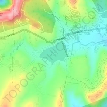
Name: Manas Lake topographic map, elevation, terrain.

Location: Manas Lake, Bhukum, Mulshi, Pune, Maharashtra, India (18.49239 73.73169 18.49829 73.73921)

Average elevation: 2,306 ft

Minimum elevation: 2,100 ft

Maximum elevation: 2,595 ft

Gear up for your next adventure:

🪶Compact Camp Shovel - Folding shovel for campsite tasks
📷Action Camera - Capture your outdoor adventures in HD
🗺️NatGeo Topo Maps - High-quality waterproof printed topographic maps of US Parks
🩳Quick‑Dry Hiking Shorts - Comfortable and quick‑dry shorts for summer hiking
🔌USB Car Charger - Car charger for on‑the‑go power needs

As an Amazon Associate, this site earns from qualifying purchases at no extra cost to you.