
Thank you for supporting this site ❤️
Make a donation
Make a donation
Gear up for your next adventure:
As an Amazon Associate, this site earns from qualifying purchases at no extra cost to you.
Avenal topographic map
Click on the map to display elevation.
Thank you for supporting this site ❤️
Make a donation
Make a donation
Gear up for your next adventure:
As an Amazon Associate, this site earns from qualifying purchases at no extra cost to you.
About this map
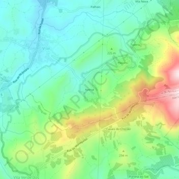
Name: Avenal topographic map, elevation, terrain.
Location: Avenal, Vilar, Cadaval, Lisbon, 2550-065, Portugal (39.15683 -9.11950 39.19683 -9.07950)
Average elevation: 679 ft
Minimum elevation: 203 ft
Maximum elevation: 1,739 ft
Thank you for supporting this site ❤️
Make a donation
Make a donation
Gear up for your next adventure:
As an Amazon Associate, this site earns from qualifying purchases at no extra cost to you.