Geolocate

Chesterfield topographic map

Click on the map to display elevation.

About this map

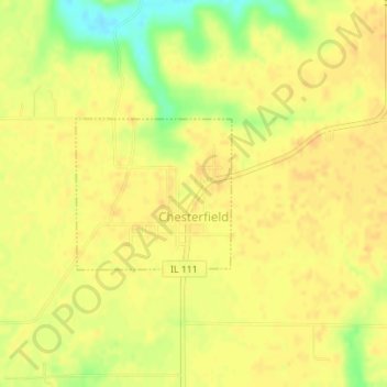
Name: Chesterfield topographic map, elevation, terrain.

Location: Chesterfield, Macoupin County, Illinois, United States (39.25132 -90.07379 39.26186 -90.05973)

Average elevation: 591 ft

Minimum elevation: 518 ft

Maximum elevation: 610 ft

Macoupin County trails, hiking, mountain biking, running and outdoor activities

Other topographic maps

Click on a map to view its topography, its elevation and its terrain.

Otter Lake

United States > Illinois > Macoupin County

Average elevation: 640 ft

Gear up for your next adventure:

🔌Solar Panel Charger - Charge gear sustainably outdoors
📱Heavy-Duty Phone Cases - Drop-proof and waterproof protection for outdoor navigation
🦟Ultrasonic Repellers - Create a bug-free zone at your camp or rest stop
🪄Magnetic Compass - Accurate compass for navigation
🪶Paracord Bracelet - Survival bracelet with built‑in tools

As an Amazon Associate, this site earns from qualifying purchases at no extra cost to you.