
Ottenburg topographic map
Interactive map
Click on the map to display elevation.
About this map
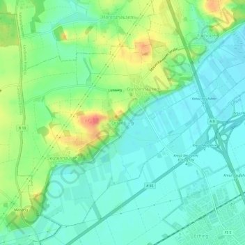
Name: Ottenburg topographic map, elevation, terrain.
Average elevation: 1,562 ft
Minimum elevation: 1,496 ft
Maximum elevation: 1,709 ft
Other topographic maps
Click on a map to view its topography, its elevation and its terrain.
Hohenkammer
Allemagne > Bavière > Landkreis Freising
Hohenkammer, Landkreis Freising, Bavière, 85411, Allemagne
Average elevation: 1,578 ft