
Alton topographic map
Click on the map to display elevation.
About this map
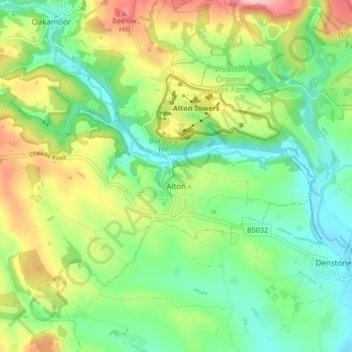
Name: Alton topographic map, elevation, terrain.
Average elevation: 512 ft
Minimum elevation: 299 ft
Maximum elevation: 892 ft
Other topographic maps
Click on a map to view its topography, its elevation and its terrain.
Kingsley Holt
United Kingdom > England > Staffordshire > Staffordshire Moorlands
Average elevation: 604 ft
Thorncliffe
United Kingdom > England > Staffordshire > Staffordshire Moorlands > Thorncliffe
Average elevation: 1,024 ft
Boundary
United Kingdom > England > Staffordshire > Staffordshire Moorlands > Boundary
Average elevation: 630 ft