
Manus topographic map
Click on the map to display elevation.
About this map
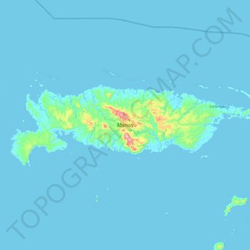
Name: Manus topographic map, elevation, terrain.
Location: Manus, Islands Region, Papua New Guinea (-2.25516 146.50535 -1.95153 147.43888)
Average elevation: 59 ft
Minimum elevation: -3 ft
Maximum elevation: 2,218 ft