
Thank you for supporting this site ❤️
Make a donation
Make a donation
Gear up for your next adventure:
As an Amazon Associate, this site earns from qualifying purchases at no extra cost to you.
Comunaglia topographic map
Click on the map to display elevation.
Thank you for supporting this site ❤️
Make a donation
Make a donation
Gear up for your next adventure:
As an Amazon Associate, this site earns from qualifying purchases at no extra cost to you.
About this map
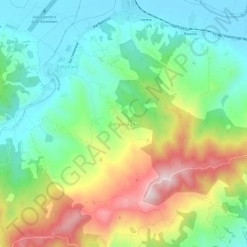
Name: Comunaglia topographic map, elevation, terrain.
Location: Comunaglia, Umbertide, Perugia, Umbria, 06019, Italia (43.31698 12.21589 43.35698 12.25589)
Average elevation: 1,276 ft
Minimum elevation: 827 ft
Maximum elevation: 2,080 ft
Thank you for supporting this site ❤️
Make a donation
Make a donation
Gear up for your next adventure:
As an Amazon Associate, this site earns from qualifying purchases at no extra cost to you.