
Komatke topographic map
Click on the map to display elevation.
Komatke
Saint John the Baptist Parish Laveen, the Saint Johns Mission, is in Komatke. The name is taken from the mission school founded by the Franciscans in 1894. It has an estimated elevation of 1,030 feet (310 m) above sea level.
About this map
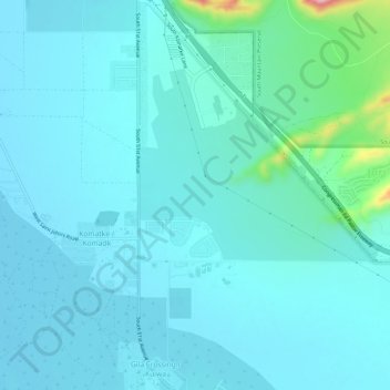
Name: Komatke topographic map, elevation, terrain.
Location: Komatke, Maricopa County, Arizona, United States (33.27412 -112.17730 33.32354 -112.15071)
Average elevation: 1,099 ft
Minimum elevation: 1,014 ft
Maximum elevation: 1,732 ft
Maricopa County trails, hiking, mountain biking, running and outdoor activities