Geolocate

Havelock topographic map

Click on the map to display elevation.

About this map
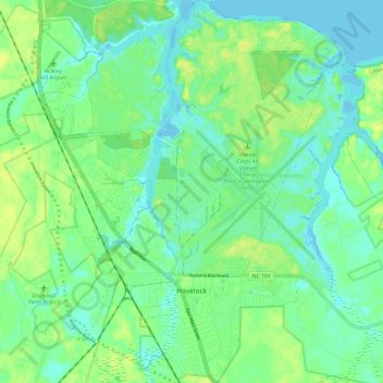
Name: Havelock topographic map, elevation, terrain.

Location: Havelock, Craven County, North Carolina, United States (34.85483 -76.94854 34.95293 -76.85322)

Average elevation: 26 ft

Minimum elevation: -10 ft

Maximum elevation: 59 ft

Craven County trails, hiking, mountain biking, running and outdoor activities

Other topographic maps

Click on a map to view its topography, its elevation and its terrain.
Ernul

United States > North Carolina > Craven County

Average elevation: 20 ft

Gear up for your next adventure:

🎒Day Hiking Backpack - Lightweight backpack perfect for day trips and outdoor adventures
🌡️Handheld Weather Meters - Measure wind, temp, and pressure for safe mountain travel
🥤Water Filter Bottle - All‑in‑one filter bottle for safe hydration
🧥Waterproof Jacket for Hiking - Breathable and rugged rain jacket for outdoor excursions
👟Trail Running Shoes - Lightweight shoes for trail runners

As an Amazon Associate, this site earns from qualifying purchases at no extra cost to you.