
Mactaquac topographic map
Interactive map
Click on the map to display elevation.
About this map
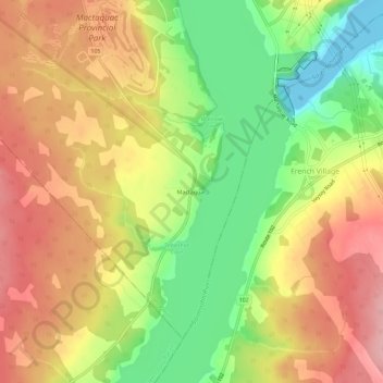
Name: Mactaquac topographic map, elevation, terrain.
Average elevation: 246 ft
Minimum elevation: -33 ft
Maximum elevation: 459 ft
Other topographic maps
Click on a map to view its topography, its elevation and its terrain.
Keswick Ridge
Canada > New Brunswick > Bright Parish
Keswick Ridge, Bright Parish, York County, New Brunswick, E6L 1S4, Canada
Average elevation: 338 ft
Central Hainesville
Canada > New Brunswick > Bright Parish
Central Hainesville, Bright Parish, York County, New Brunswick, Canada
Average elevation: 768 ft