Geolocate

Hogen topographic map

Click on the map to display elevation.

About this map

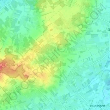
Name: Hogen topographic map, elevation, terrain.

Location: Hogen, Geetbets, Leuven, Vlaams-Brabant, 3450, België (50.86246 5.06006 50.90246 5.10006)

Average elevation: 141 ft

Minimum elevation: 75 ft

Maximum elevation: 279 ft

Gear up for your next adventure:

🧺Microfiber Travel Towels - Compact and fast-drying towels for trail use
🧦Merino Wool Socks - Moisture-wicking, blister-preventing socks for long treks
🎒Waterproof Dry Bags - Keep your electronics and maps dry inside your pack
🌡️Portable Weather Meter - Track weather conditions on the trail
🏥Hiking First Aid Kits - Comprehensive medical kits for remote trail injuries

As an Amazon Associate, this site earns from qualifying purchases at no extra cost to you.