
Thank you for supporting this site ❤️
Make a donation
Make a donation
Gear up for your next adventure:
As an Amazon Associate, this site earns from qualifying purchases at no extra cost to you.
ad-Damer topographic map
Click on the map to display elevation.
Thank you for supporting this site ❤️
Make a donation
Make a donation
Gear up for your next adventure:
As an Amazon Associate, this site earns from qualifying purchases at no extra cost to you.
About this map
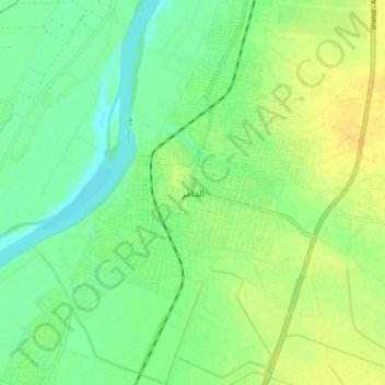
Name: ad-Damer topographic map, elevation, terrain.
Location: ad-Damer, River Nile State, Sudan (17.54302 33.92870 17.62302 34.00870)
Average elevation: 1,165 ft
Minimum elevation: 1,129 ft
Maximum elevation: 1,201 ft
Thank you for supporting this site ❤️
Make a donation
Make a donation
Gear up for your next adventure:
As an Amazon Associate, this site earns from qualifying purchases at no extra cost to you.