
Elberon topographic map
Interactive map
Click on the map to display elevation.
About this map
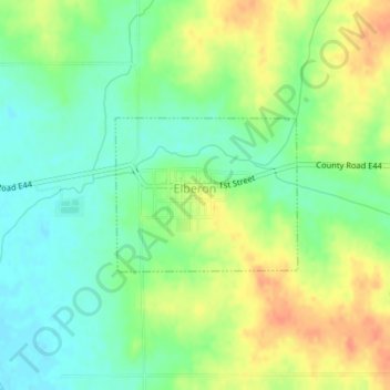
Name: Elberon topographic map, elevation, terrain.
Location: Elberon, Tama County, Iowa, United States (42.00003 -92.32453 42.01071 -92.30749)
Average elevation: 869 ft
Minimum elevation: 807 ft
Maximum elevation: 948 ft
Other topographic maps
Click on a map to view its topography, its elevation and its terrain.
Gladbrook
United States > Iowa > Tama County
Gladbrook, Tama County, Iowa, United States
Average elevation: 984 ft
Dysart
United States > Iowa > Tama County
Dysart, Tama County, Iowa, United States
Average elevation: 961 ft
Toledo
United States > Iowa > Tama County
Toledo, Tama County, Iowa, United States
Average elevation: 883 ft