
Make a donation
Gear up for your next adventure:
As an Amazon Associate, this site earns from qualifying purchases at no extra cost to you.
Hohloh topographic map
Click on the map to display elevation.
Make a donation
Gear up for your next adventure:
As an Amazon Associate, this site earns from qualifying purchases at no extra cost to you.
About this map
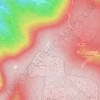
Name: Hohloh topographic map, elevation, terrain.
Average elevation: 2,904 ft
Minimum elevation: 1,808 ft
Maximum elevation: 3,228 ft
Make a donation
Gear up for your next adventure:
As an Amazon Associate, this site earns from qualifying purchases at no extra cost to you.
Other topographic maps
Click on a map to view its topography, its elevation and its terrain.
Staufenberg
Deutschland > Baden-Württemberg > Landkreis Rastatt > Gernsbach
Average elevation: 1,053 ft
Reichental
Deutschland > Baden-Württemberg > Landkreis Rastatt > Gernsbach
Die auf einer Anhöhe gelegene neugotische Kirche St. Mauritius überragt das Dorf. Sie wurde 1897–1898 nach Plänen von Johannes Schroth errichtet und im Jahr 1900 durch Friedrich Justus Knecht geweiht. Den Hochaltar und den Marien-Seitenaltar der Mauritiuskirche schuf 1901 Franz Joseph Simmler, die…
Average elevation: 2,113 ft
Scheuern
Deutschland > Baden-Württemberg > Landkreis Rastatt > Gernsbach > Scheuern
Average elevation: 919 ft
Make a donation
Gear up for your next adventure:
As an Amazon Associate, this site earns from qualifying purchases at no extra cost to you.
Lautenbach
Deutschland > Baden-Württemberg > Landkreis Rastatt > Gernsbach
Average elevation: 1,276 ft