Geolocate

Adelshofen topographic map

Click on the map to display elevation.

About this map

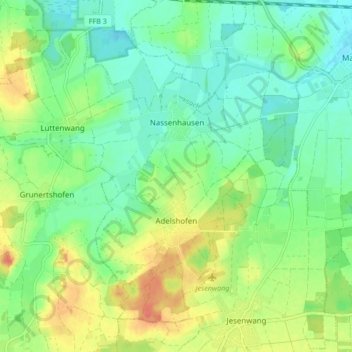
Name: Adelshofen topographic map, elevation, terrain.

Location: Adelshofen, Verwaltungsgemeinschaft Mammendorf, Landkreis Fürstenfeldbruck, Bayern, 82276, Deutschland (48.16701 11.05850 48.21386 11.14301)

Average elevation: 1,808 ft

Minimum elevation: 1,739 ft

Maximum elevation: 1,929 ft

Other topographic maps

Click on a map to view its topography, its elevation and its terrain.

Gernlinden

Deutschland > Bayern > Landkreis Fürstenfeldbruck

Average elevation: 1,677 ft

Luttenwang

Deutschland > Bayern > Landkreis Fürstenfeldbruck

Average elevation: 1,811 ft

Biburg

Deutschland > Bayern > Landkreis Fürstenfeldbruck

Average elevation: 1,867 ft

Egg

Deutschland > Bayern > Landkreis Fürstenfeldbruck > Mammendorf

Average elevation: 1,798 ft

Vogach

Deutschland > Bayern > Landkreis Fürstenfeldbruck

Average elevation: 1,693 ft

Tegernbach

Deutschland > Bayern > Landkreis Fürstenfeldbruck

Average elevation: 1,729 ft

Gear up for your next adventure:

🗺️Topographic Maps - Detailed topo maps for hiking, exploring and outdoor navigation
🦶Carbon Trekking Poles - Reduce knee impact on steep descents with ultra-light poles
📚USA Hiking Guide Books - Top trail guides and map books
🪑Portable Camp Table - Compact table for campsite meals
🧷Carabiner Set - Durable clips for gear attachment

As an Amazon Associate, this site earns from qualifying purchases at no extra cost to you.