
Dover topographic map
Click on the map to display elevation.
About this map
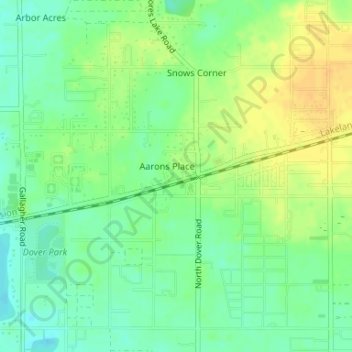
Name: Dover topographic map, elevation, terrain.
Location: Dover, Hillsborough County, Florida, 33527, United States (27.98162 -82.23623 28.00688 -82.20330)
Average elevation: 108 ft
Minimum elevation: 62 ft
Maximum elevation: 154 ft
Hillsborough County trails, hiking, mountain biking, running and outdoor activities
Other topographic maps
Click on a map to view its topography, its elevation and its terrain.