
Thank you for supporting this site ❤️
Make a donation
Make a donation
Gear up for your next adventure:
As an Amazon Associate, this site earns from qualifying purchases at no extra cost to you.
Ypresse topographic map
Click on the map to display elevation.
Thank you for supporting this site ❤️
Make a donation
Make a donation
Gear up for your next adventure:
As an Amazon Associate, this site earns from qualifying purchases at no extra cost to you.
About this map
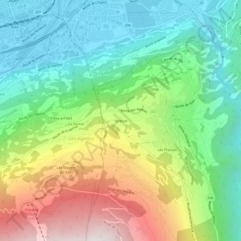
Name: Ypresse topographic map, elevation, terrain.
Location: Ypresse, Vex, Hérens, Valais, 2305, Suisse (46.19111 7.36473 46.23111 7.40473)
Average elevation: 3,127 ft
Minimum elevation: 1,588 ft
Maximum elevation: 5,922 ft
Thank you for supporting this site ❤️
Make a donation
Make a donation
Gear up for your next adventure:
As an Amazon Associate, this site earns from qualifying purchases at no extra cost to you.