Geolocate

Monte Leone topographic map

Click on the map to display elevation.

About this map

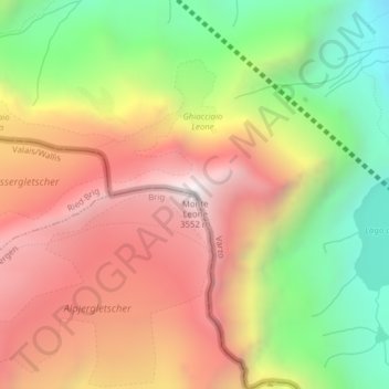
Name: Monte Leone topographic map, elevation, terrain.

Location: Monte Leone, Zwischbergen, Brig, Wallis, 3907, Switzerland (46.24946 8.11011 46.24956 8.11021)

Average elevation: 9,245 ft

Minimum elevation: 6,713 ft

Maximum elevation: 11,611 ft

Gear up for your next adventure:

🥾Hiking Shoes - Durable and comfortable shoes for trail hiking
🌡️Portable Weather Meter - Track weather conditions on the trail
🧭Orienteering Set - Complete compass and map reading kit
🔥Camping Stove - Portable stove for camping and backcountry cooking
🕶️GPS Smartphone Mount - Secure mount for phone navigation

As an Amazon Associate, this site earns from qualifying purchases at no extra cost to you.