
Thank you for supporting this site ❤️
Make a donation
Make a donation
Gear up for your next adventure:
As an Amazon Associate, this site earns from qualifying purchases at no extra cost to you.
Negroyacu topographic map
Click on the map to display elevation.
Thank you for supporting this site ❤️
Make a donation
Make a donation
Gear up for your next adventure:
As an Amazon Associate, this site earns from qualifying purchases at no extra cost to you.
About this map
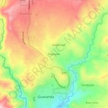
Name: Negroyacu topographic map, elevation, terrain.
Location: Negroyacu, Guaranda, Bolívar, 020101, Ecuador (-1.59646 -79.01849 -1.55646 -78.97849)
Average elevation: 9,173 ft
Minimum elevation: 8,488 ft
Maximum elevation: 9,823 ft
Thank you for supporting this site ❤️
Make a donation
Make a donation
Gear up for your next adventure:
As an Amazon Associate, this site earns from qualifying purchases at no extra cost to you.
Other topographic maps
Click on a map to view its topography, its elevation and its terrain.