
Thank you for supporting this site ❤️
Make a donation
Make a donation
Gear up for your next adventure:
As an Amazon Associate, this site earns from qualifying purchases at no extra cost to you.
Sant'Antonio topographic map
Click on the map to display elevation.
Thank you for supporting this site ❤️
Make a donation
Make a donation
Gear up for your next adventure:
As an Amazon Associate, this site earns from qualifying purchases at no extra cost to you.
About this map
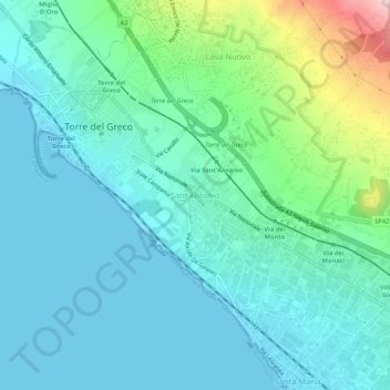
Name: Sant'Antonio topographic map, elevation, terrain.
Location: Sant'Antonio, Torre del Greco, Napoli, Campania, 80059, Italia (40.76084 14.36134 40.80084 14.40134)
Average elevation: 207 ft
Minimum elevation: 0 ft
Maximum elevation: 1,073 ft
Thank you for supporting this site ❤️
Make a donation
Make a donation
Gear up for your next adventure:
As an Amazon Associate, this site earns from qualifying purchases at no extra cost to you.