
Make a donation
Gear up for your next adventure:
As an Amazon Associate, this site earns from qualifying purchases at no extra cost to you.
Motihari topographic map
Click on the map to display elevation.
Make a donation
Gear up for your next adventure:
As an Amazon Associate, this site earns from qualifying purchases at no extra cost to you.
Motihari
The topography of Motihari has been described as scenic, with the "stunning beauty" (in classical terms) of Moti Jheel Lake dividing the town in two halves.
Make a donation
Gear up for your next adventure:
As an Amazon Associate, this site earns from qualifying purchases at no extra cost to you.
About this map
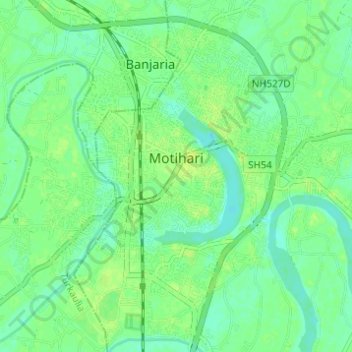
Name: Motihari topographic map, elevation, terrain.
Location: Motihari, East Champaran, Bihar, India (26.62038 84.88740 26.67530 84.94135)
Average elevation: 220 ft
Minimum elevation: 197 ft
Maximum elevation: 243 ft
Make a donation
Gear up for your next adventure:
As an Amazon Associate, this site earns from qualifying purchases at no extra cost to you.