
Thank you for supporting this site ❤️
Make a donation
Make a donation
Gear up for your next adventure:
As an Amazon Associate, this site earns from qualifying purchases at no extra cost to you.
Lund topographic map
Click on the map to display elevation.
Thank you for supporting this site ❤️
Make a donation
Make a donation
Gear up for your next adventure:
As an Amazon Associate, this site earns from qualifying purchases at no extra cost to you.
About this map
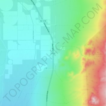
Name: Lund topographic map, elevation, terrain.
Location: Lund, White Pine County, Nevada, 89317, United States (38.81862 -115.04788 38.89862 -114.96788)
Average elevation: 5,764 ft
Minimum elevation: 5,466 ft
Maximum elevation: 6,690 ft
White Pine County trails, hiking, mountain biking, running and outdoor activities
Thank you for supporting this site ❤️
Make a donation
Make a donation
Gear up for your next adventure:
As an Amazon Associate, this site earns from qualifying purchases at no extra cost to you.