
Thank you for supporting this site ❤️
Make a donation
Make a donation
Gear up for your next adventure:
As an Amazon Associate, this site earns from qualifying purchases at no extra cost to you.
Tripartito topographic map
Click on the map to display elevation.
Thank you for supporting this site ❤️
Make a donation
Make a donation
Gear up for your next adventure:
As an Amazon Associate, this site earns from qualifying purchases at no extra cost to you.
About this map
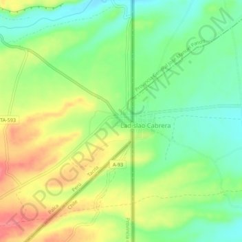
Name: Tripartito topographic map, elevation, terrain.
Location: Tripartito, Palca, Tacna, Perú (-17.51524 -69.49044 -17.47524 -69.45044)
Average elevation: 13,461 ft
Minimum elevation: 13,350 ft
Maximum elevation: 13,602 ft
Thank you for supporting this site ❤️
Make a donation
Make a donation
Gear up for your next adventure:
As an Amazon Associate, this site earns from qualifying purchases at no extra cost to you.