Geolocate

Homeland topographic map

Click on the map to display elevation.

About this map
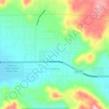
Name: Homeland topographic map, elevation, terrain.

Location: Homeland, Riverside County, California, 92548, United States (33.73175 -117.12785 33.75947 -117.08721)

Average elevation: 1,811 ft

Minimum elevation: 1,552 ft

Maximum elevation: 2,343 ft

Riverside County trails, hiking, mountain biking, running and outdoor activities

Gear up for your next adventure:

🧥Waterproof Jacket for Hiking - Breathable and rugged rain jacket for outdoor excursions
🚗GPS Dash Cams - Record your scenic drives through mountain passes and canyons
🛌Ultralight Sleeping Bags - Compact down bags for cold nights in the wilderness
🎁Geography Themed Gifts - Unique gift ideas for map lovers and geography enthusiasts
📡Handheld GPS Device - Reliable handheld GPS for outdoor navigation

As an Amazon Associate, this site earns from qualifying purchases at no extra cost to you.